United States Census Bureau. "Americanindiansmapcensusbureau." 2006, Wikimedia Commons, https://commons.wikimedia.org/wiki/File:Americanindiansmapcensusbureau.gif. [This image has been cropped from the original].
Originally the Otoe and Missouria tribes originated in the Great Lakes Region of the United States. There is the belief that the Otoe, Missouria, Iowa, and Winnebago people were one tribe until the 1600s. The Otoe (or Oto) were a tribe originally living in the meeting point of present day states, Nebraska, Iowa, Missouri, and Kansas. The Otoe were joined by the Missouria tribe around 1804 due to loss of life from other natives and diseases from the Europeans such as smallpox. The tribe is now located in Red Rock, Oklahoma (“Facts.”).
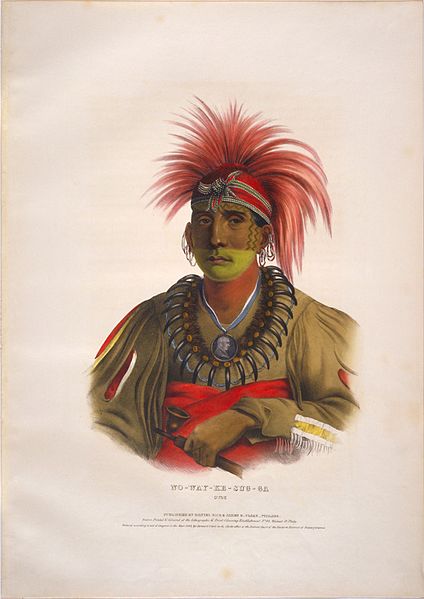
This image was created of Nowaykesugga when a large delegation of Indians came to Washington in the winter of 1821-1822 to see President Monroe. The President wanted to impress the Native American delegations that came to D.C with the United States’s size and power. The head of the United States Bureau of Indian Affairs, Thomas McKenney, commissioned artists to capture the likeness of these visitors. His main goal in compiling these prints was to preserve something of their culture as he recognized them to be an integral part to the history of the United States.
Ancestral Lands
U.S. National Park Service, restoration/cleanup by Matt Holly. "Lewis and Clark Trail Map", 2017, Wikimedia Commons, https://commons.wikimedia.org/wiki/File:NPS_lewis-and-clark-trail-map.pdf.
Tribal Lands
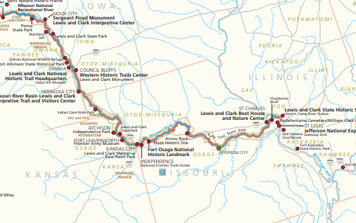
The Otoe ancestral lands were located in several states. The Otoe homeland was at the intersection of present day Nebraska, Iowa, Missouri, and Kansas. The image of Lewis and Clark’s Trail Map shows where these states meet.
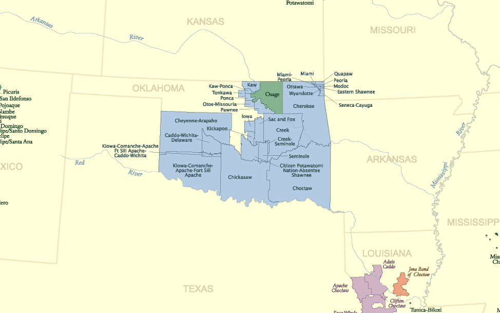
Today's Reservations
United States Census Bureau. "Americanindiansmapcensusbureau." 2006, Wikimedia Commons, https://commons.wikimedia.org/wiki/File:Americanindiansmapcensusbureau.gif. [This image has been cropped from the original and a red dot has been added to show location of the tribe].
Current Tribal Lands
By August 1804 the Otoe and Missouri tribes combined as one tribe for protection. This was noted by Lewis and Clarks travel journal. Originally, the Otoe-Missouri tribe was confined to a reservation in southeast Nebraska in 1855. This land was continuously sold by acre every year to non-Indians. In 1881 the tribe was then moved to Red Rock, Oklahoma where the tribe currently lives.
To visit the Otoe-Missouria tribe page click on the link below: