Maps

- Map of Seneca Villages and Jesuit/French Contacts 1615-1708. This map depicts Seneca villages as drawn by French colonists. The Senecas didn’t have much interaction with the French, but the French were in the St. Lawrence area in Canada, which is on the other side of Lake Ontario, so they would have created maps like this one to locate themselves on any land around Lake Ontario.
 To His Excellency William Tryon ESQ. Captain General & Governor in Chief of the Province of New York & & This Map of the Country of the VI Nations Proper with Part of the adjacent colonies, is humbly inscribed by his Excellency’s most obedient humble servant Guy Johnson 1771″
This is from the Livingston County Historical Society Museum’s website. This map would have been created for the English Captain General William Tryon ESQ, as he was fighting or planning to fight the Six Nations. As European settlers first arrived in North America, in the 1500s and 1600s, the six nations created the Iroquois Confederacy in order to unite their forces and defend their lands against invading European settlers.
Cindy Amrhein argues in her book, A History of Native American Land Rights in Upstate New York, that the European settlers learned what not to do with native populations through their interactions with the natives of New York State, because they treated the Six Nations as sovereign nations or foreign powers. While this was clearly the more ethical thing to do, this pattern was not followed in other areas of the country, because it slowed and complicated European settlement, while burning Indian villages and forcibly removing the native people from their land sped up the process. From this map you can see that the author/creator of the map drew the six nations into the area as foreign powers with rights over certain parts of the land.
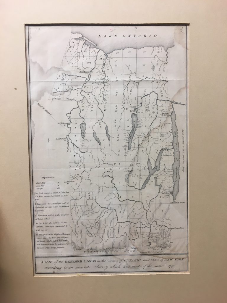
“A Map of Genesee Lands in the County of Ontario and State of New York according to an accurate survey which was made of the same. 1790.”
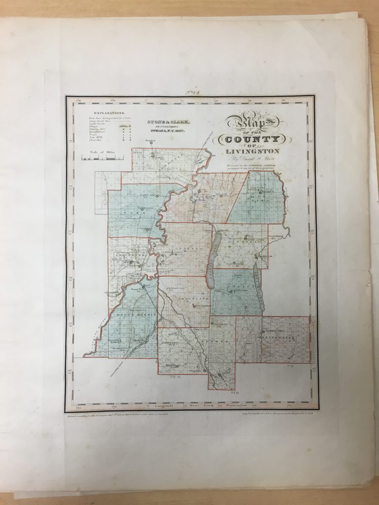 Map of the County of Livingston, David H. Burr 1840, c. 1829
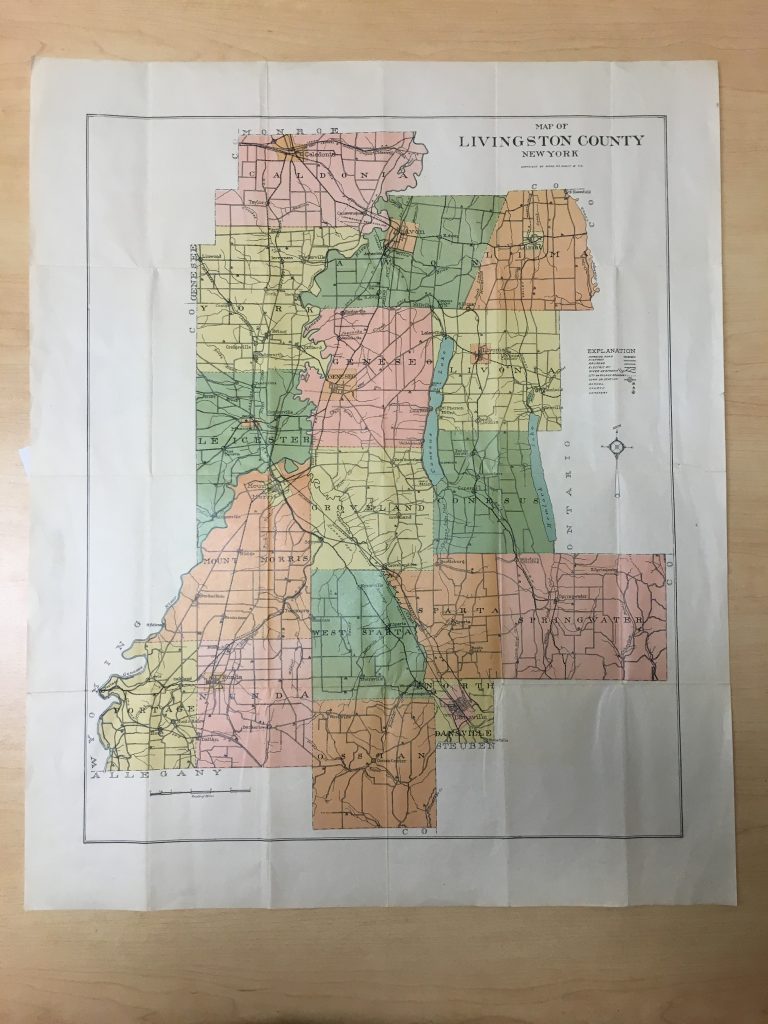
Map of Livingston County–Rand McNally 1900?
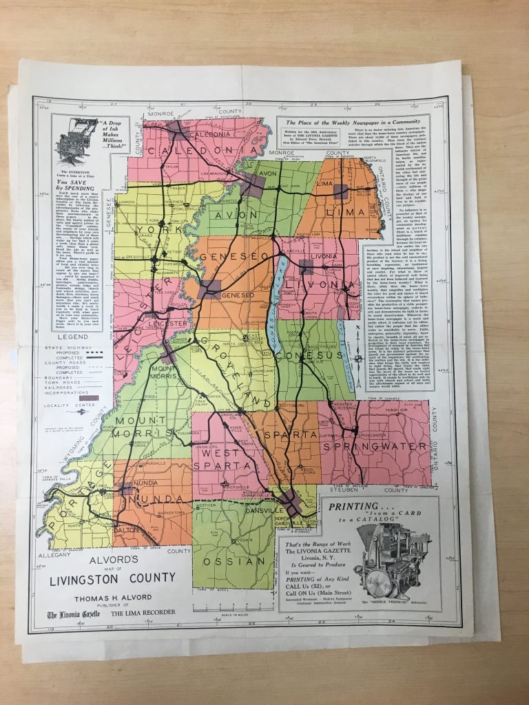
Alvord’s Map of Livingston County, Rochester, NY–1940
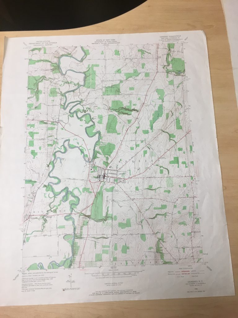
Geneseo Quadrangle–US Geological Survey, 1978. This geological survey is really useful when looking at the other maps, because the space in the center of the map where all the red lines meet is Geneseo, and the dark twisting line on the left side of the photo is the Genesee river. Looking for the river in each of these maps allows easier location of Geneseo.
 This is a visitors map of Geneseo, NY from 1999. Geneseo looks similar, if not the same, today as it does here with the occasional business swapped for another.