“Legal Dispute” – Challenging Narratives of Erasure

Corruption at Effigy Mounds

Effigy Mounds is located in Northeast Iowa and is home to multiple Plains Tribes burial grounds. This area has long been considered a “‘sacred place where Nations meet'” (Blake) by many Native American tribes, but in 1990 tragedy struck. The caretakers appointed by the United States government stole over 40 sets of remains from the Mounds and National Monument Museum. These bone were put in garbage bags and left in someone’s garage to sit for almost thirty years.In 2011, this corruption/evil act was discovered and an investigation was launched to prove that the bones were stolen and to return them to their rightful home. Finally, in 2016 guilty members parties were sentenced.

Lance Foster, the Tribal Historic Preservation Officer for the Iowa Tribe of Kansas and Nebrask said, “They’re secure. Plans are being made to repatriate them and the tribes are going to be part of that process. It will be done as soon as we can get everything figured out, to put them back here somewhere.” The many tribes, whose ancestors are buried at Effigy Mounds, will work together and come to a consensus about the reburial of their Tribal Ancestors as a group.

If you want to read more about the incident, the link below will take you to the news article about the story.

Returned to their journey: Bones of 41 American Indians removed from Effigy Mounds returned to their tribes for reburial

As a side note/slight digression from this story, I think that it would be interesting to interview Native American tribe members to hear their thoughts on sacred Native places being used as National Monuments/tourist attractions.
The Pre-contact Landscape

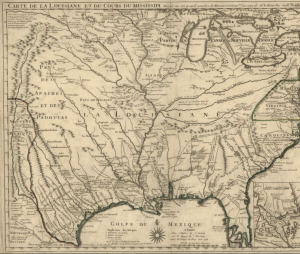
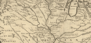
European contact in the area that is today know as Missouri began in the late 1600s when French explorers traveled along the Mississippi River. One of the earliest maps of this area was created in 1718 by Guillaume de L’lsle, and his map actually shows much of United States with a large emphasis on the rivers and waterways.

Image from the Library of Congress Geography and Map Division, Washington Control Number: 2001624908

A more close-up look of the Northern Missouri area shows how the land of the Ioway was between three major rivers.

Excerpt from previous image.

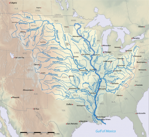
In comparison, a map from today shows that there are two more rivers/waterways intersecting the area north of the Missouri River than were shown on the map from 1718.

Wikimedia Commons: Mississippiriver-new-01.png

While the first two maps do not predate European contact, they seems to focus more on the land as it’s own property, and not as something to be owned by people which is similar to the views of the Ioway, and most Native American tribes. In contrast, many of the other maps that I found focused on the 1800s when U.S. settlers were moving into the area and claiming land. The maps were divided by artificial lines marking ownership and counties.

Links to Pictures:

https://www.loc.gov/resource/g3700.ct000666/?r=0.448,0.246,0.372,0.329,0

https://commons.wikimedia.org/wiki/File:Mississippiriver-new-01.png

The Treaty of August 4, 1824

On August 4 in the year 1824, the Ioway tribe signed a treaty with the U.S. government ceding much of their land in the state of Missouri. The treaty itself is relatively short, taking up only a few lines, but it gave up large portions of Ioway territory. It was signed in Washington D.C. by two Ioway Chiefs, White Cloud and Great Walker (Big Neck). These two chiefs represented different portions of the Ioway tribe, and as evidenced by the Big Neck Affair there was some controversy related to it’s signing.

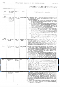
This first document, “Schedule of Indian Land Cessions-Continued,” shows that the treaty signed by the Ioway is only one of many treaties that Indian nations signed during this period.

https://memory.loc.gov/cgi-bin/ampage?collId=llss&fileName=4000/4015/llss4015.db&recNum=158&itemLink=D?hlaw:1:./temp/~ammem_ojQn::

The second document is a screenshot of the exact wording for the 1824 treaty between the Ioway and the United States government.

https://memory.loc.gov/cgi-bin/ampage?collId=llss&fileName=4000/4015/llss4015.db&recNum=158&itemLink=D?hlaw:1:./temp/~ammem_ojQn::

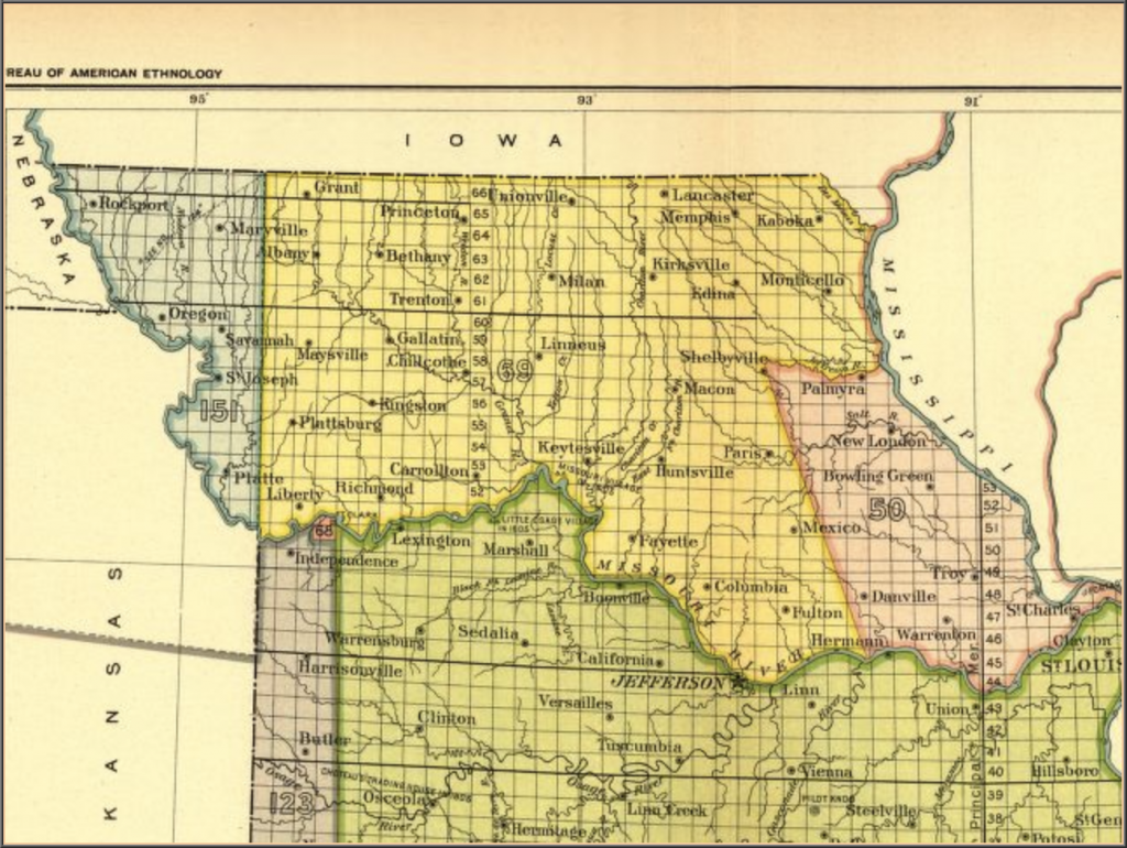
Finally, the third image shows the land that the Ioways ceded in Northern Missouri in the 1824 treaty. Adair County and Kirksville, which is the primary land area this project is focusing on, are in this cession. The yellow portion of the map below, with the number 69 on it, shows the ceded land.

https://memory.loc.gov/cgi-bin/map_item.pl

Sources:

Library of Congress – American Memory

A Century of Lawmaking for a New Nation: U.S. Congressional Documents and Debates, 1774-1875

U.S. Serial Set, Number 4015, 56th Congress, 1st Session, Pages 706-707

Indian Land Cessions in the United States, 1784 to 1894

Baxoje, the Ioway Nation – nativeweb.org

Ioway Cultural Institute: History

Treaties Page