French Fur Traders and Missouri Lands
The French were the ones that gained control of the Mississippi River and its entire watershed as well as the lands surrounding the river. The Indians traded with the French in order to get metal implements, such as, knives, awls, needles, and kettles, as well as blankets, beads, and tobacco so the French could get the hides of buffalo, beaver, or flat tails in return. (Olsen 17). As the Ioway began gathering metal implements, they began to stop making their own implements and the rituals associated with the production of these tools for their tribe (Olsen 19-20).
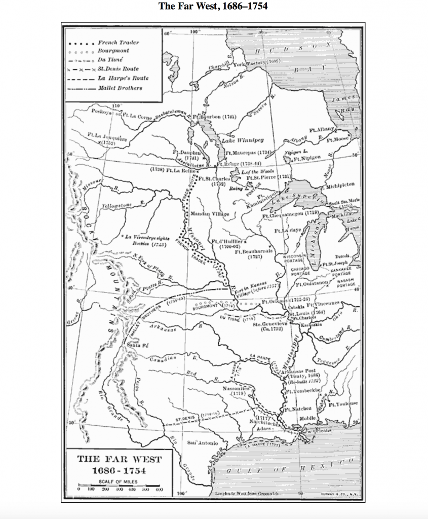
The Far West map not only shows the locations of towns and the date of their settlements, but it also shows the routes of several different groups including French traders. An important feature to note when looking at these routes is that the French traveled straight through Native lands without distinction. The map is composed to note the movement of these groups as well as provide emphasis to the locations of water sources such as rivers, bays, gulfs, and lakes. It also notes where mountain regions are located. The locations of these are important as often traders would use waterways such as rivers to travel to locations to trade and would often trade with Native Americans they found in that area. Equally as important, the map’s main features are items that Native Americans would find important and there are no artificial boundaries noted.
The first town established in present day Missouri can be located on this map. Ste. Genevieve was established ca. 1732-1750s right next to the Mississippi river. The reason there is such a large date range for this settlement is that the French settlers viewed it as a non-event. They did not even bother to put down the exact date especially because Ste. Genevieve was just an extension of their farming town on the opposite side of the river. The establishment of Ste. Genevieve was not the beginning of European colonists, particularly French colonists, trade with Native Americans. In fact, one historian actually claims that “traversing the Mississippi–to trade with Indians, to gather salt, to mine lead–was not unusual” (Anson 41). Trading with Native Americans across the Mississippi was a common activity for French colonists, and continued all the way through the establishment of St. Louis in 1764. When the Missouria tribe learned of this new European settlement, many Missouria attempted to move closer to St. Louis in order to gain protection from the Great Osage tribe, but they were rebuffed by French officials who did not want to endanger any trade agreements with opposing tribes.
Sources:
Aron, Stephen. American Confluence: The Missouri Frontier from Borderland to Border State. Indiana University Press, 2009.
Olsen, Greg. The Ioway in Missouri. University of Missouri, 2008.