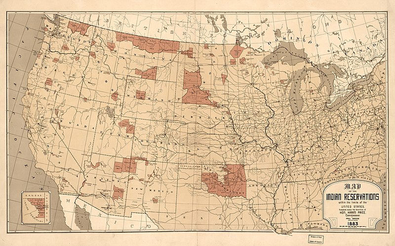
Brodie, P. T, and Hiram Price. "Map Showing Indian Reservations with the Limits of the United States." 1883, The Library of Congress Geography and Map Division, Washington, www.loc.gov/item/2009579475/.
The people of the Missouria called themselves the “Niutachi” or “People of the River Mouth”. However, as the French, Spanish, and the British came into the territory they continuously recorded and called them the Missouria. Originally, the Otoe and Missouria tribes originated in the Great Lakes Region of the United States (present day Wisconsin). The Otoe, Missouria, Iowa, and Winnebago people were one tribe until the 1600s when they split from each other. The Missouria stayed as a tribe of its own until it joined with the Otoe around 1804. Initially, these two tribes lived together at the junction of the Missouri River and the Grand River.
Before the joining of these two tribes, the Missouria controlled the trade happening on the river, and when the French arrived in the area, they continued their dominance of the trade with the protection of the French. When the French left, after selling their claim on the area, the Missouria were attacked by the Sac and the Fox. After much loss from these attacks, the Missouria moved up river to be closer to the Little Osage. After a last attack from the Winnebagos in 1777 and much loss from diseases, the Missouria tribe separated and portions joined with Otoe, Ioway, Osage, and Kaw villages (“Facts.”).
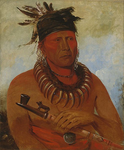
Háwchekesúgga
Catlin, George. "Háw-che-ke-súg-ga, He Who Kills the Osages, Chief of the Tribe". 1832, oil on canvas, Smithsonian American Art Museum, https://americanart.si.edu/artwork/haw-che-ke-sug-ga-he-who-kills-osages-chief-tribe-4094.
This Missouria Chief was painted by George Catlin. Catlin depicted the Chief with a necklace of grizzly bear claws and a carved pipe in his hand. Catlin met this war chief after the Missouria numbers were reduced, and they joined with the Otoes. This painting was probably painted by Caltin at Fort Levenworth, which is now in present day Kansas, in 1832.
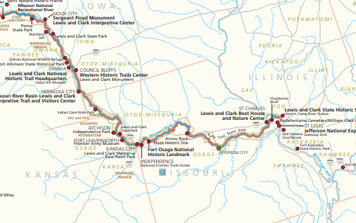
Ancestral Lands
U.S. National Park Service, restoration/cleanup by Matt Holly. "Lewis and Clark Trail Map", 2017, Wikimedia Commons, https://commons.wikimedia.org/wiki/File:NPS_lewis-and-clark-trail-map.pdf.
Tribal Lands
The Missouria tribe was located near the junction of the Missouri and Grand Rivers. In the 1700s, French explorers, Louis Joilliet and Jacques Marquette, traveled through this region. They mapped a village of the Missouria at the Great Bend in the Missouri River, which is now in present day Saline County. Later, Lewis and Clark would map the Missouria tribe to be located at the junction of the Chariton River and the Grand River in Missouri (“Facts.”).
Today's Reservations
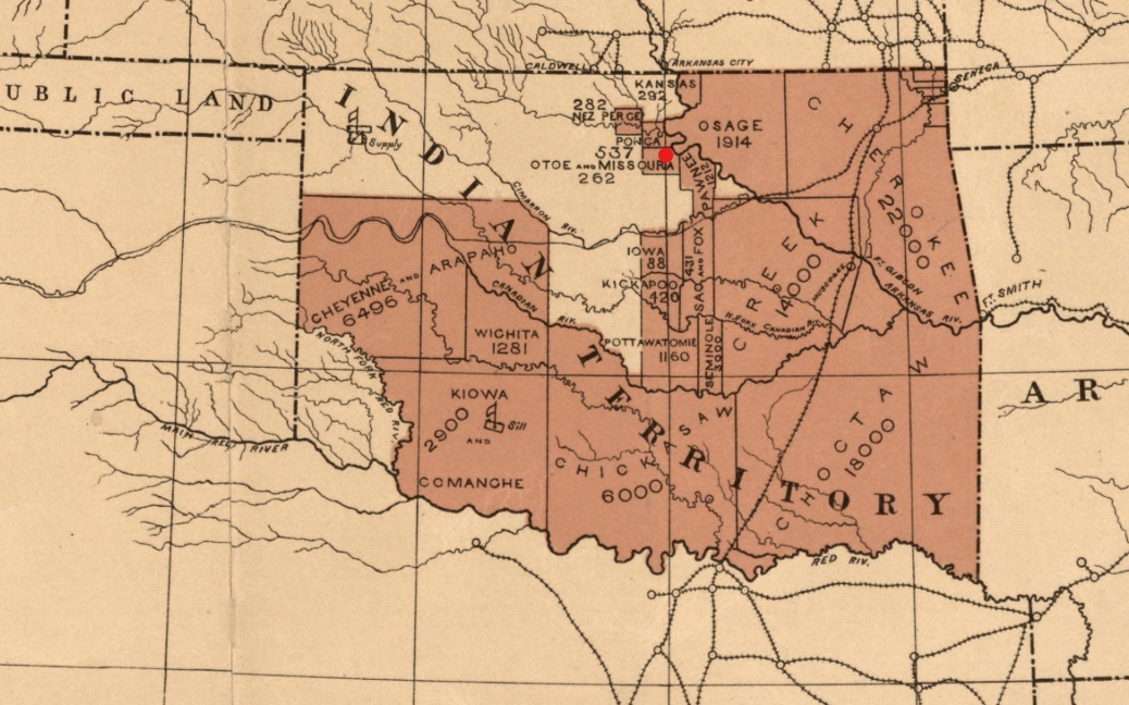
Brodie, P. T, and Hiram Price. "Map Showing Indian Reservations with the Limits of the United States." 1883, The Library of Congress Geography and Map Division, Washington, www.loc.gov/item/2009579475/. [An alteration has been made to this image; it has been cropped and edited with a red dot to signify the location of the Otoe-Missouria Reservation]
Current Tribal Lands
By August 1804, the Otoe and Missouria tribes combined as one tribe for protection from other tribes in the area. Their numbers had decreased from smallpox and other tribes’ aggression. This date of change from two separate tribes to one combined tribe was noted in Lewis and Clark’s travel journal. In 1830, the Otoe-Missouria tribe ceded lands for the first time to the United States. Originally, in 1855, the Otoe-Missouri tribe was confined to a reservation in southeast Nebraska. This land was continuously sold acre by acre every year to non-Indians. In 1881, the tribe was then moved to Red Rock, Oklahoma where the tribe currently lives.
To visit the Otoe-Missouria tribe's page click on the link below: